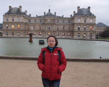
王雪蕾
基本信息
出生年月:1978年12月
学位:博士
联系地址:北京市海淀区永丰基地丰德东路环境保护部卫星环境应用中心水环境遥感部
邮政编码:100094
电话:58311562
Email:wangxl@secmep.cn,wxlbnu@gmail.com
教育背景
博士后 2008.7-2010.7北京师范大学水科学研究院
合作导师:刘昌明院士 杨胜天教授
博士学位 2005.9-2008.7 北京师范大学地理学与遥感科学学院,自然地理专业
指导教师:杨胜天教授;研究方向:岸边带生态水文过程模拟
联合培养 2007.11-2008.5 荷兰地理信息科学与对地观测学院(ITC)
合作导师:Chris M.Mannaerts副教授;合作方向:遥感模型与生态水文模型耦合
硕士学位 2002-2005 北京师范大学环境学院,环境工程专业
指导教师:王金生教授;研究方向:土壤水动态模拟
学士学位 1998-2002 东北师范大学城市与环境科学学院,环境科学专业
指导教师:王宁教授;研究课题:湖泊底泥磷释放规律研究(内源非点源污染研究)
参与科研项目及会议
1. 国家自然科学基金项目“岸边缓冲带对非点源污染控制效应的遥感解析(40671123)”(2007-2009)
2国家863项目——饮用水安全评价与预警中的低空艇载高分辨率遥感技术(2006AA12Z145)2006.12-2009.12
3国家科技支撑计划“黄河生态系统保护目标及生态需水研究” (2006BAB06B07)(2006-2009)
发表文章
1.Xuelei Wang, Mannaerts, C. M, Shengtian Yang, et al. 2010.Evaluation of soil nitrogen removal from riparian zones using a process-oriented model coupled with remote sensing data. Science of the total environment. 408(16), 3310-3318
2.Xuelei Wang, Shengtian Yang, Mannaerts, C. M, et al. 2009. Spatially explicit estimation of soil denitrification rates and land use effects in the riparian buffer zone of a large reservoir.Geoderma: a global journal of soil science. 150(3-4), 240-252
3.WeiOuyang, Xuelei Wang, FanghuaHao, Srinivasan R. 2009. Temporal-spatial dynamics of vegetation variation on non-point source nutrient pollution Ecological Modelling, 220(20): 2702-2713
4.WeiOuyang, FanghuaHao, Xuelei Wang. 2008. Non point source pollution responses simulation for conversion cropland to forest in mountains by SWAT in China. Environmental Management, 41(1): 79-89
5.WeiOuyang, FanghuaHao, Xuelei Wang. 2008. Regional non point source organic pollution modeling and critical area identification for watershed best environmental management. Water, Air, & Soil Pollution, 187(1-4): 251-261
6. 王雪蕾,杨胜天, 高云飞, 等. 2009. 库滨带土壤释氮负荷模型的构建与田间尺度模拟分析. 环境科学学报, 29(5): 1077-1085.
7.王雪蕾,刘昌明, 杨胜天, 等. 2009. RIP_N模型对官厅水库库滨带去氮效应的流域尺度模拟分析. 环境科学, 30(9), 2502-2511
8.王雪蕾,杨胜天, 智泓, 等. 2007. 官厅水库库滨带非点源污染控制效应的遥感分析. 环境科学学报, 27(2): 304-312
9. 杨胜天,王雪蕾,刘昌明, 等. 2007. 岸边带生态系统研究进展.环境科学学报,27(6): 894-905
10. 王雪蕾, 杨胜天, 郝芳华, 等. 2007. 都江堰灌区金马河河流健康空间形态分析. 北京师范大学学报(自然科学版), 43(4):
452-456
11. 王雪蕾, 王金生, 王宁. 2005. 四平市二龙湖底泥磷释放研究. 环境污染治理技术与设备, 6(9):47-50
12. 王雪蕾, 王金生, 宣昊, 等. 2004. 灰色聚类法在运城盆地中层地下水质评价中的应用.杭州环境科学, 10(1) :28-31
13.Xuelei Wang, Shengtian Yang, Chris M. Mannaerts,HongjuanZeng, DonghaiZheng. 2010. Modeling riparian soil nitrogen removal based on a modified SWAT model coupled to remote sensing data. Sixth international symposium on digital earth: data processing and applications, edited by huadongGuo,Changlin Wang,Proc. Of SPIE Vol.7841,78411c1-9.(EI)
14.Xuelei Wang, Yang Shengtian, HaoFanghua,et al. 2007. The Analysis of Remote Sensing to Jinma River in Dujiangyan Irrigation Regions. Proceedings of the Third International Symposium on Future Intelligent Earth Observing Satellites(FIEOS), May 24-26,2006, Beijing, China: 445-448
